Geography: Important Maps from the Bosnian Genocide
|
|
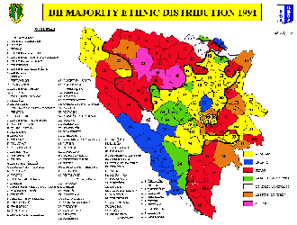
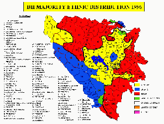
These are ethnic maps of Bosnia from the years 1991 to 1996. The blue represents the Muslim population in Bosnia. As you can see, the map from 1996 has much less blue than the map from 1991. In general, there is much less diversity on the map from 1996. This shows the affects of the “ethnic cleansing that occurred” during the Bosnian Genocide.
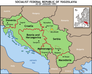
This is a map of Yugoslavia in 1991. It was divided into five semi-autonomous republics before three wars broke out during this time period (in the 90’s). In 1991, Slovenia and Croatia declared independence while Bosnia and Herzegovina did the same in 1992. Yugoslavia is one of the most ethnically diverse nations in Europe, partially due to the Ottoman conquest of the country from the 15th-19th century which led to an influx of Muslim populations. It then fell under Austro-Hungarian rule in the 19th century. In 1918, Yugoslavia became its own independent state, leaving a legacy of ethnic and cultural influences remaining in its provinces.
